


Date & Time:
Jun 2, 2018 at 1433 LT
Type of aircraft:
Piper PA-31-350 Navajo Chieftain
Operator:
Bernard J. Krupinski
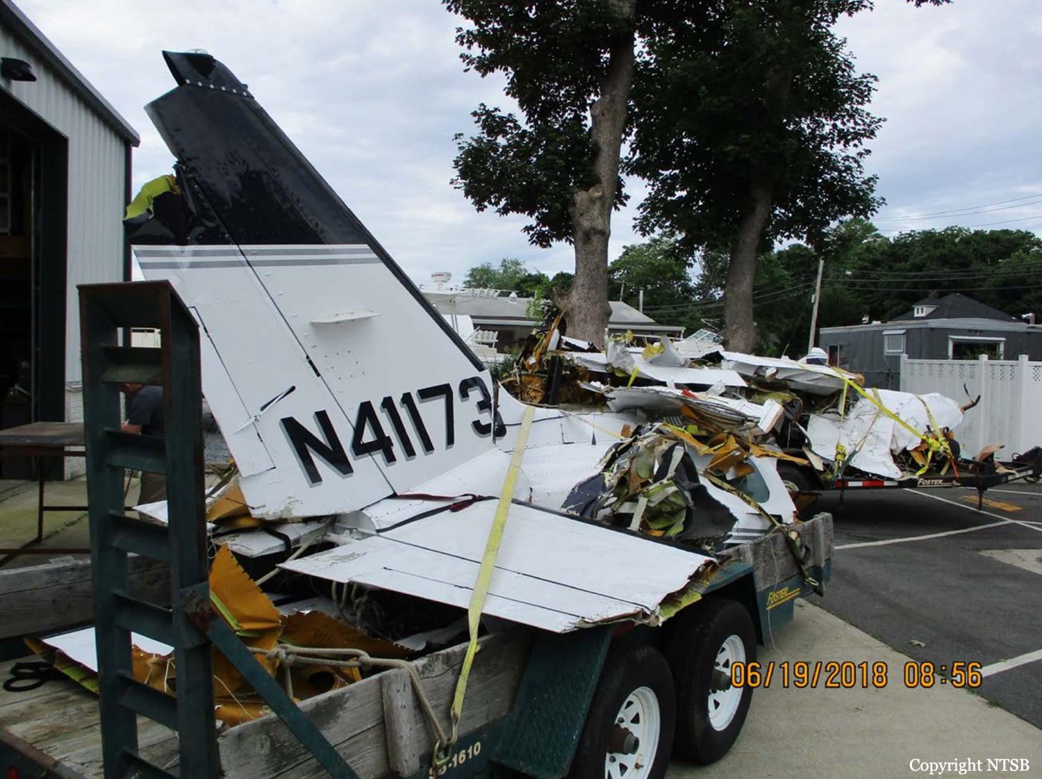
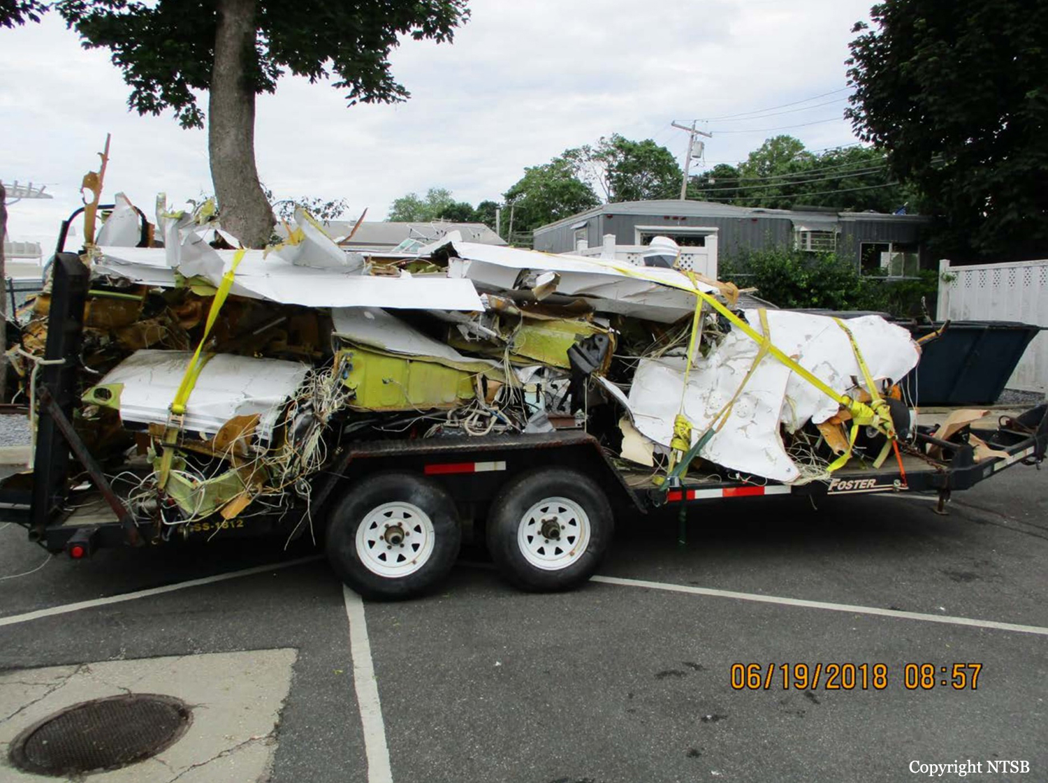
Registration:
N41173
Flight Phase:
Landing (descent or approach)
Flight Type:
Private
Survivors:
No
Site:
Lake, Sea, Ocean, River
Schedule:
Newport – East Hampton
MSN:
31-8452017
YOM:
1984
Country:
United States of America
Region:
North America
Crew on board:
1
Crew fatalities:
1
Pax on board:
3
Pax fatalities:
3
Other fatalities:
0
Total fatalities:
4
Aircraft flight hours:
5776
Circumstances:
The commercial pilot of the multiengine airplane was the first of a flight of two airplanes to depart on the cross-country flight, most of which was over the Atlantic Ocean. The pilot of the second airplane stated that he and the accident pilot reviewed the weather for the route and the destination before departing; however, there was no record of the accident pilot receiving an official weather briefing and the information the pilots accessed before the flight could not be determined. The second pilot departed and contacted air traffic control, which advised him of thunderstorms near the destination; he subsequently altered his route of flight and landed uneventfully at the destination. The second pilot stated that he did not hear the accident pilot on the en route air traffic control frequency. Two inflight weather advisories were issued for the route and the area of the destination about 42 and 15 minutes before the accident flight departed, respectively, and warned of heavy to extreme precipitation associated with thunderstorms. It could not be determined whether the accident pilot received these advisories. Review of air traffic control communications and radar data revealed that, about 5 miles from the destination airport, the pilot of the accident airplane reported to the tower controller that he was flying at 700 ft and "coming in below" the thunderstorm. There were no further communications from the pilot. The airplane's last radar target indicated 532 ft about 2 miles south of the shoreline. The airplane was found in about 50 ft of water and was fragmented in several pieces. Postaccident examination revealed no preimpact anomalies with the airplane or engines that would have precluded normal operation. A local resident about 1/2 mile from the accident site took several photos of the approaching thunderstorm, which documented a shelf cloud and cumulus mammatus clouds along the leading edge of the storm, indicative of potential severe turbulence. Review of weather imagery and the airplane's flight path showed that the airplane entered the leading edge of "extreme" intensity echoes with tops near 48,000 ft. Imagery also depicted heavy to extreme intensity radar echoes over the accident site extending to the destination airport. It is likely that the pilot encountered gusting winds, turbulence, restricted visibility in heavy rain, and low cloud ceilings in the vicinity of the accident site and experienced an in-flight loss of control at low altitude. Such conditions are conducive to the development of spatial disorientation; however, the reason for the pilot's loss of control could not be determined based on the available information.
Probable cause:
The pilot's decision to fly under a thunderstorm and a subsequent encounter with turbulence and restricted visibility in heavy rain, which resulted in a loss of control.
Final Report:
N41173.pdf344.79 KB


